 Meteorologist Jeff House monitors weather sites Monday at the downtown TVA building. Bad weather is expected to hit the area this week.
Staff Photo by Angela Lewis/Chattanooga Times Free Press
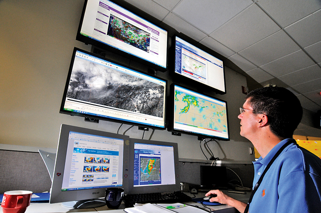
Meteorologist Jeff House monitors weather sites Monday at the downtown TVA building. Bad weather is expected to hit the area this week.
Staff Photo by Angela Lewis/Chattanooga Times Free PressWEATHER WARNINGS
To get the latest severe weather updates, follow the Times Free Press on Twitter.
Weather forecasters are watching a particularly troubling storm that is moving east and expected to hit North Alabama, East Tennessee and much of Kentucky on Wednesday, bringing lots of rain and a high probability of tornadoes.
"It's scary," said Patrick Walsh, Tennessee Valley Authority's manager for operations analysis. "I looked at that forecast [Monday] morning and thought it is eerily similar to the forecast last May in Middle Tennessee when the flood hit Nashville."
Last year, Nashville's Cumberland River crested at 51.86 feet, its highest mark since 1937. Twenty-one people were killed in Tennessee, including 10 in Davidson County.
For now, TVA's Walsh and Jeff House, who works with Walsh, will watch the new storm system carefully, trying to help river flood managers know how much rain the Tennessee River and its tributaries must absorb and how much power might be needed as the system moves in and out of the utility's seven-state region.
Derek Eisentrout, a hydro-meteorologist technician for the National Weather Service in Morristown, Tenn., called the storm "a robust system" with the possibility of tornadoes, severe thunderstorms, strong hail and wind gusts in excess of 60 mph.
"This kind of moderate risk [forecast] doesn't show up that much for us three days in advance like this," he said. "This can be a very active weather day."
Greg Carbin, warning coordination meteorologist for the National Oceanic and Atmospheric Administration, said there's never been a "high risk" forecast that came three days out. In fact, there have only been 10 moderate-risk three-day forecasts since meteorologists began calculating longer-range severe thunderstorm outlooks in 2000.
Paul Barys with WRCB-TV Channel 3 said the moderate-risk early forecast from the NOAA Storm Prediction Center means forecasters at the center, located in Norman, Okla., "are really sure there will be tornado watches ... and some of them may be for long-lasting ones."
Barys said the storm has been "trapped" in the Midwest right now. It has dumped 5 to 10 inches of rain on the Ohio Valley and Ozarks.
But he said forecasters expect a wave of air to flow off the West Coast - "what we call a 'kicker' in the weather business" - to move the system more quickly through the eastern half of Tennessee, sparing the region some of that drenching rain.
Unfortunately, that kicker is also what will add the tornado danger to the line of storms, Barys said.
"Some of these tornadoes could be the long-lasting ones ... There's the potential, so get a weather radio now and program it to your county," Barys said.
Hamilton County's Emergency Management chief, Bill Tittle, said local emergency managers had a weather briefing on the storm Monday, and they will have another briefing today.
"They told us we're going to be at high risk [for tornadoes]," he said.
But he added that he worries people will not take the forecast seriously enough.
"We keep having these warnings, and I worry that people will get used to it and just think we're crying wolf," Tittle said. "We had some damage on Signal Mountain and Red Bank [in recent months], but nothing like what could happen."
Tennessee Valley Authority's river operations planners have been watching this storm for days as it swelled the Ohio and Mississippi rivers - which the Tennessee River flows into. At the same time, other storms have dumped lots of water on headwaters of the 552-mile Tennessee River, said David Bowling, manager of TVA's River Forecast Center.
So even as river managers need to lower the river system's lake levels to make room for more runoff, they also must be careful not to add to problems in towns along the Ohio and Mississippi rivers.
During this time of year, when TVA normally is letting lake levels rise for summer recreation, "we've had a lot of questions about spilling as much water [at dams] as we have been," Bowling said. "But when you see a forecast like this, it justifies it."
Carbin, the warning coordination meteorologist for NOAA, pointed to a meteorology graduate student's research showing that only once has the Chattanooga region edged into a moderate-risk forecast three days out from the arrival of the storm.
That storm, on New Year's Eve in 2005, resulted in 19 tornado reports in Tennessee, Georgia and Kentucky, according to the research. One of those tornado reports was a possible touchdown in Grundy County in which a barn roof was damaged.
Contact Pam Sohn at psohn@timesfreepress.com or 423-757-6346.