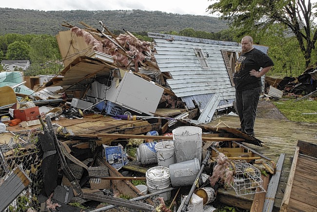
 William Hart stands next to the only remaining corner of his home on Aster Avenue in Tiftonia on Wednesday after strong storms came through the area, causing widespread damage. He huddled with his 3-year-old son, Liam Hart, until the storms passed.
GET THE LATEST UPDATES
Follow the storm damage live blog.Get weather alerts on Twitter and Facebook.
The next wave of storms is expected to be moving through the Chattanooga region between 2 and 4 p.m., and they will be stronger than those that moved through this morning, National Weather Service officials told emergency responders this morning.
And the storms are expected to contain "tornadic supercells," said meteorologist David Hotz.
Additional threats will be high winds, possibly golf-ball sized hail and more heavy rain, he said.
The last of these storms should be passing out of the Cumberland Plateau region between 5 and 8 p.m., passing out of the Chattanooga Valley area between 6 and 9 p.m. and out of the Bradley County area between 7-10 p.m., Hotz said.
Local officials urged people to stay tuned to their weather radios and close to safe shelter.