Widespread flooding causing school delays, closures

Monday, September 5, 2011
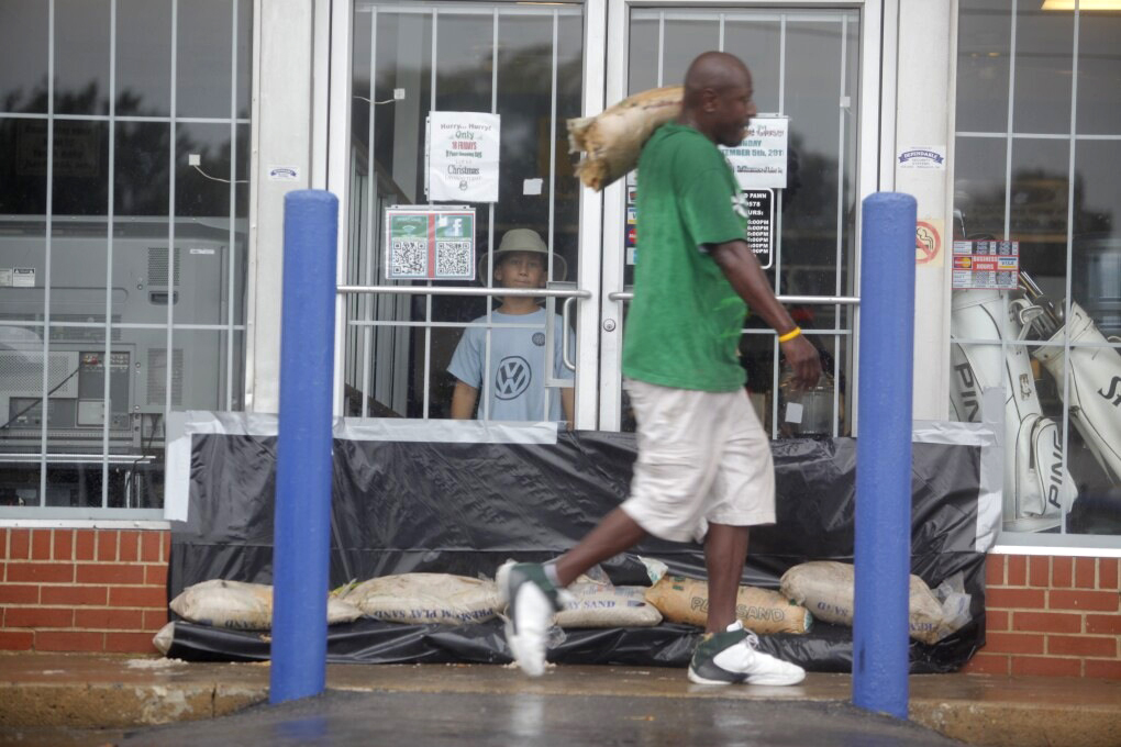 Aaron Hilliard, 8, watches from inside as Neal Rogers carries a sand bag to shore up the doorways on the family's store, Household Pawn, on Monday. Steve Hilliard says his youngest son was born on the day in 2003 when his
store, located at the intersection of 23rd Street and Orchard Knob, was previously flooded with between 3-4 feet of water.
Aaron Hilliard, 8, watches from inside as Neal Rogers carries a sand bag to shore up the doorways on the family's store, Household Pawn, on Monday. Steve Hilliard says his youngest son was born on the day in 2003 when his
store, located at the intersection of 23rd Street and Orchard Knob, was previously flooded with between 3-4 feet of water.School delays and closings
There will be a 2-hour delay for Hamilton County Schools on Tuesday. Superintendent Rick Smith indicated he will further evaluate the situation.• Cleveland City Schools and Bradley County Schools are closed Tuesday. Some Cleveland school buildings have received rain damage.• McMinn County Schools are closed Tuesday.• Notre Dame High School is opening at 10:10 a.m.• OLPH is operating on a 2-hour delay.• Polk County Schools are closed Tuesday.• Chattooga County Schools will be delayed two hours Tuesday.• Catoosa County Schools will be on a 2-hour delay Tuesday.• Walker County Schools will be on a 2-hour delay Tuesday.• The Walker County Campus of Georgia Northwestern Technical College will be on a 2-hour delay and open at 10 a.m. tomorrow. All other campuses will operate on regular schedules.• Baylor School will start at 10 a.m.Business closingsKoch foods in Chattanooga will be closed tonight.
Earlier Article:
Rain at last, but flooding worries loomWeather forecast:See a map of projected weather activityShare your photos:Send images and videos of the weather to webeditor@timesfreepress.comGet breaking weather alerts:Join us on Facebook and follow us on Twitter.
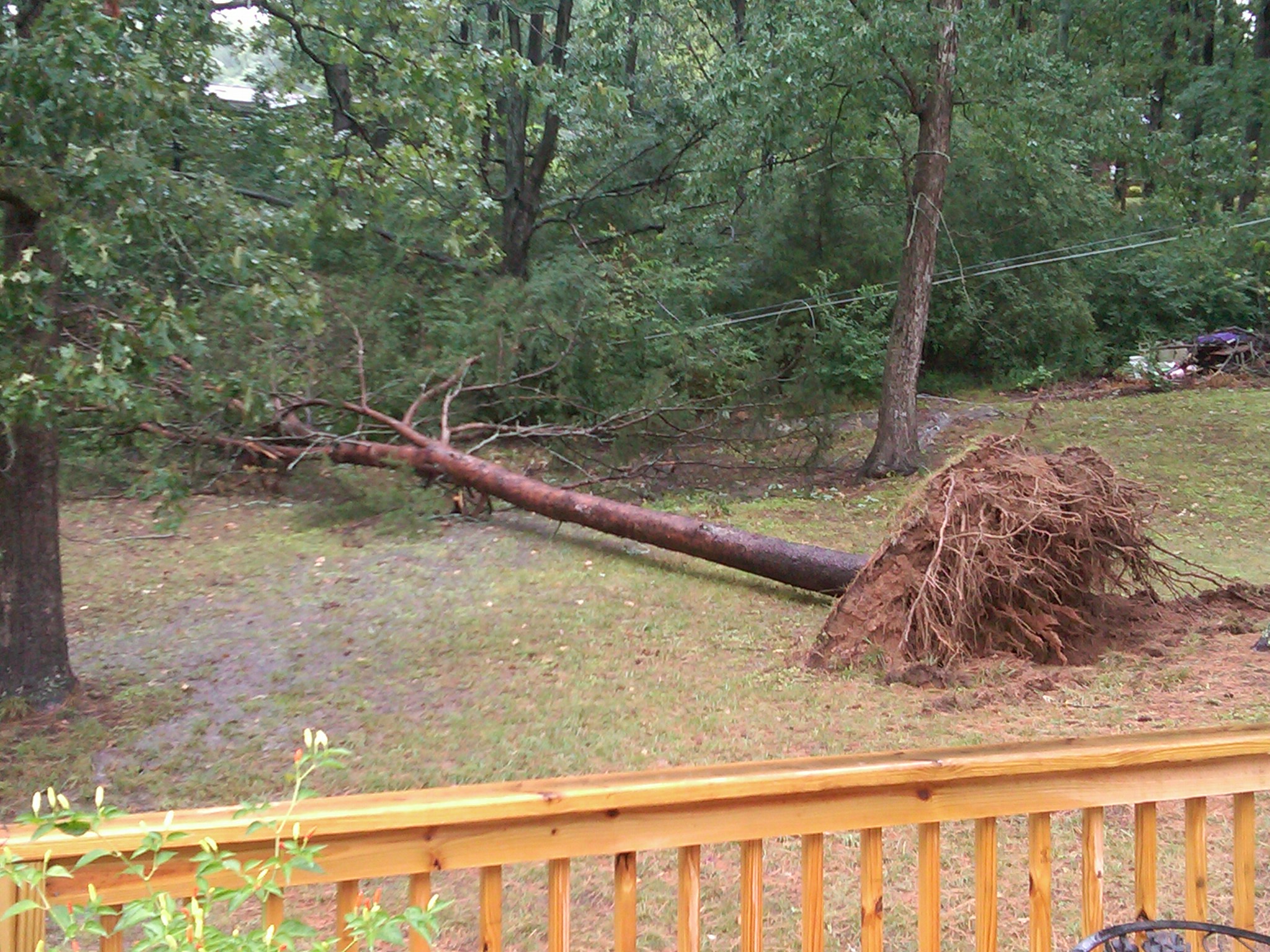 100 ft pine tree fell in backyard in Holly Hills.
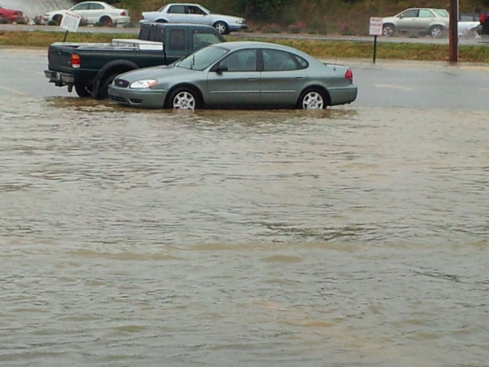
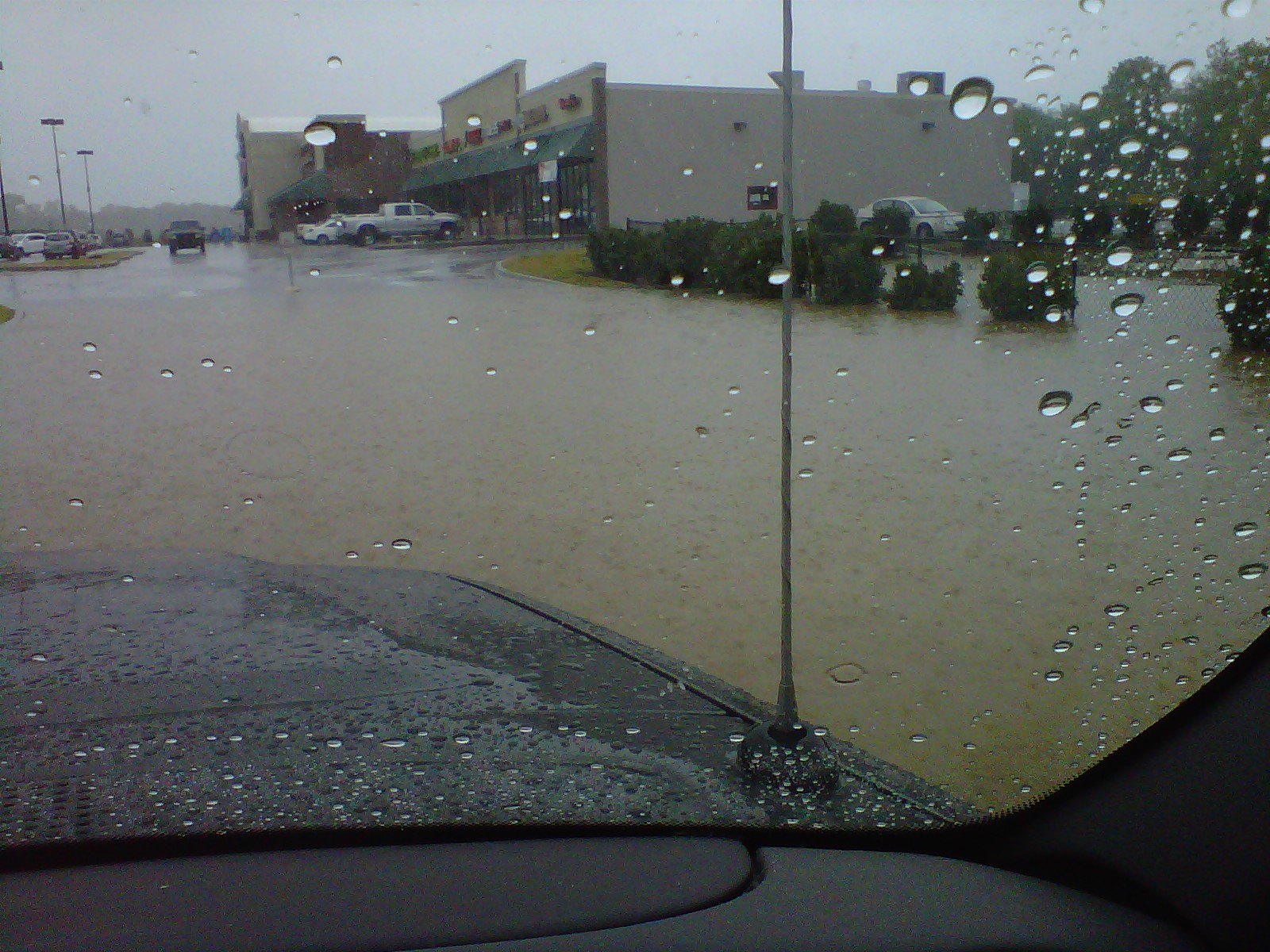
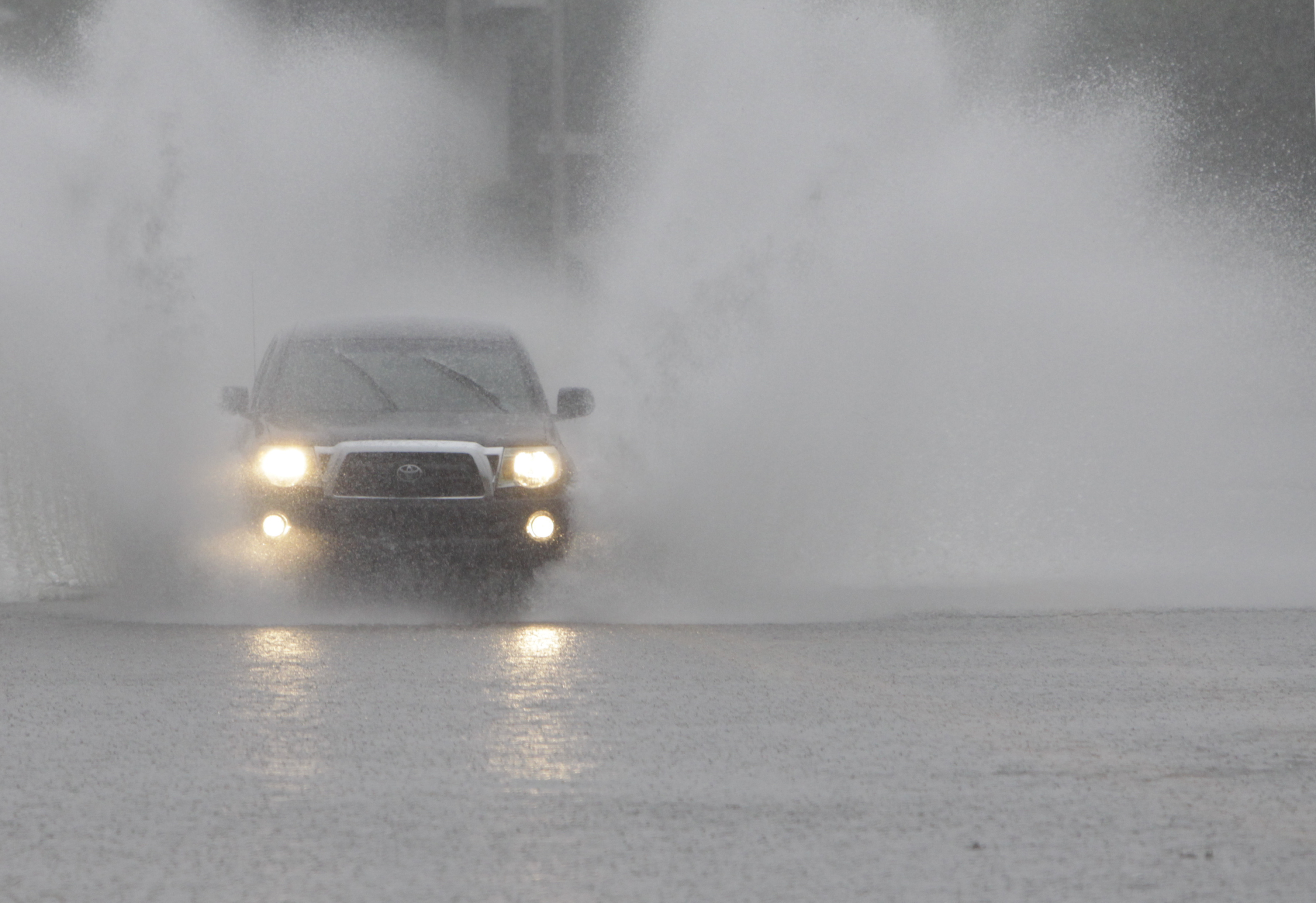 A motorist makes their way through flood waters covering Airport Rd. after heavy overnight rains filled area creeks.
 Raindrops on a car window show the sign for the historic Chattanooga Choo-Choo hotel downtown today, as the remnants of a tropical storm Lee pelted the region with rain. The National Weather Service predicts rain through Wednesday, with possible flooding.
HAPPENING NOW: EMS reports 18 people have been evacuated by boat from Battlewood Apartments in Fort Oglethorpe.
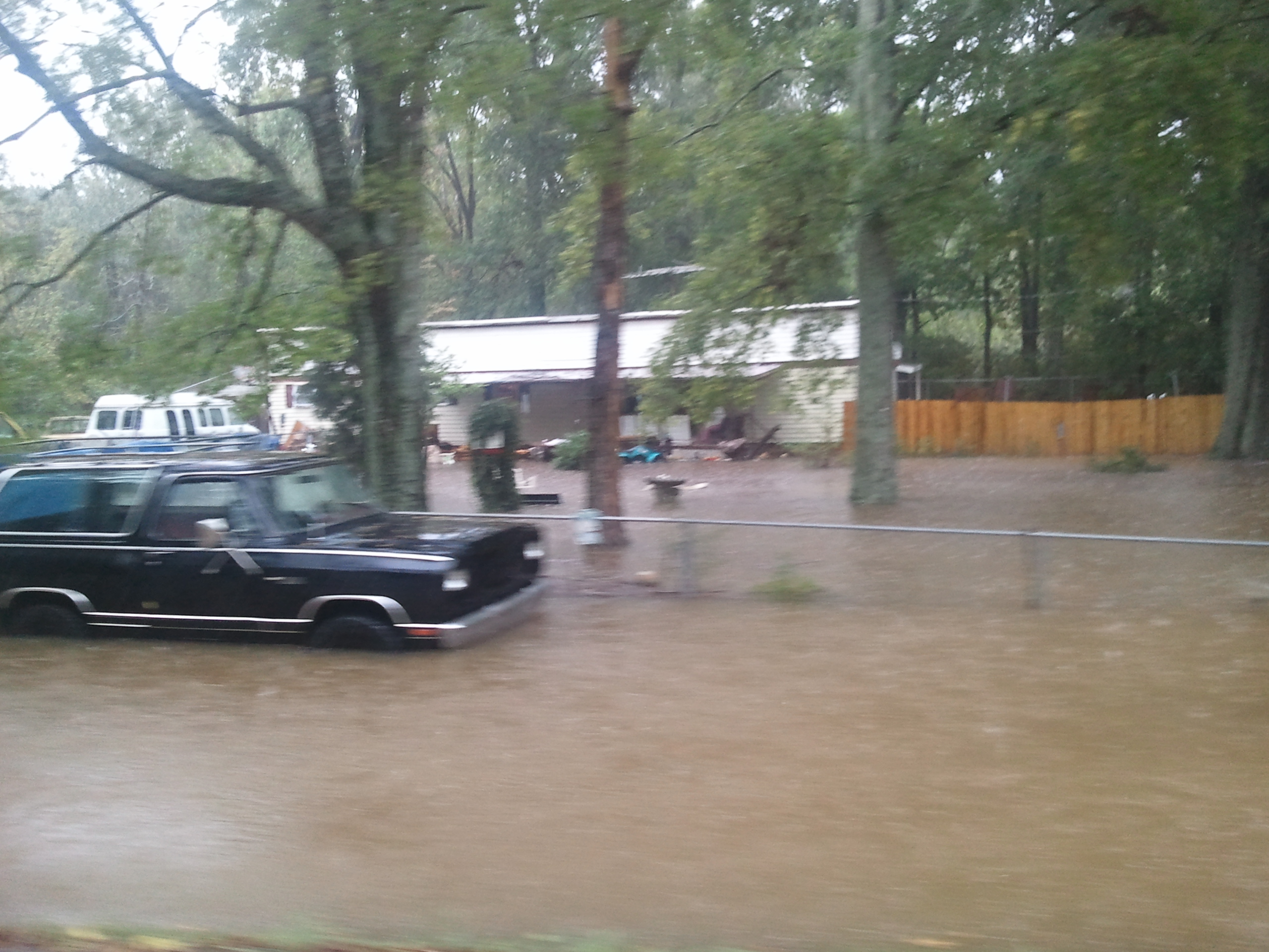
Heavy, steady rainfall that began Sunday has led to widespread flooding across the Southeast Tennessee and North Georgia area, authorities said this afternoon.
Dozens of downtown Chattanooga streets are closed off as the remains of tropical storm Lee continue to dump water onto the once-parched ground. The area could receive up to 10 inches of rain by Tuesday night, according to forecasters.
The rains come after the driest August on record here.
Traffic was slowed to a crawl on portions of Interstate 24 through Chattanooga, and a number of motorists were stranded after trying to drive through deep water.
Chattanooga Police Department spokesman Sgt. Jerri Weary said motorists should avoid areas where water is rising and not drive through those streets.
About 2,100 homes and businesses are without power and nearly 20 crews are working throughout the coverage area, EPB spokeswoman Danna Bailey said.
Flooding is expected to continue through Tuesday afternoon, according to the National Weather Service in Morristown, Tenn.
"In the Chattanooga area we've seen about 6 inches of rain so far, and we're looking at about four inches more by tomorrow night," said Chuck Bach, general manager for river scheduling for the Tennessee Valley Authority, which operates a network of 49 dams on the Tennessee River and its tributaries for flood control and recreation. "We're not seeing any flooding below our dams right now but we are seeing some localized flooding [on streams and creeks that flow into the Tennessee]."
Chattanooga police said that several areas throughout the city have experienced flooding within the last several hours. They encouraged motorists to avoid the below-mentioned areas or find alternate routes:
· E 20th Street @ Market Street
· 20th Street @ Market Street
· 5200 Austin Road
· A tree is down @ Talley road near Montview
· 2200 Gunbarrel Road near Smokey Bones Restaurant
· 900 E Main Street
· E 32nd Street @ Clio Avenue
· 5707 Brainerd Road near the IHOP Restaurant
· Hickory Valley Road @ E Brainerd Road
· Main @ Central
· 7530 Shallowford Road @ Murray Lane
· McCutcheon Road
· 500 E 11th Street
· 105 Melrose Drive @ Brainerd Road
· 4713 Arrowhead
· 208 Shawnee Trail
• S. Kelly Street between 18th and 23rd Streets
• E. Brainerd Rd @ Jenkins
• 4100 Jersey Pike
• Shallowford Rd @ Lee Hwy
• 1400 Ely Rd
• Amnicola @Stuart St
• 3100 Rossville Blvd
• Madison St @19th St
• 150 Browns Ferry
• Jersey Pike @ Shallowford
• Tree down @Big Ridge Rd and Hamill
• Tree down on Camden Street
More flooded areas reported:
• 500 E 10th St.
• N. Moore Road @ Arrowhead
• Peoples Street
• Valleybrook Road
• 1800 E. 23rd St.
• Lynnbrook Road
• 1900 E 24th St. Place
• 2600 Standifer Gap Road