Sequatchie Valley scenic byway map ready for inspection
Friday, January 1, 1904
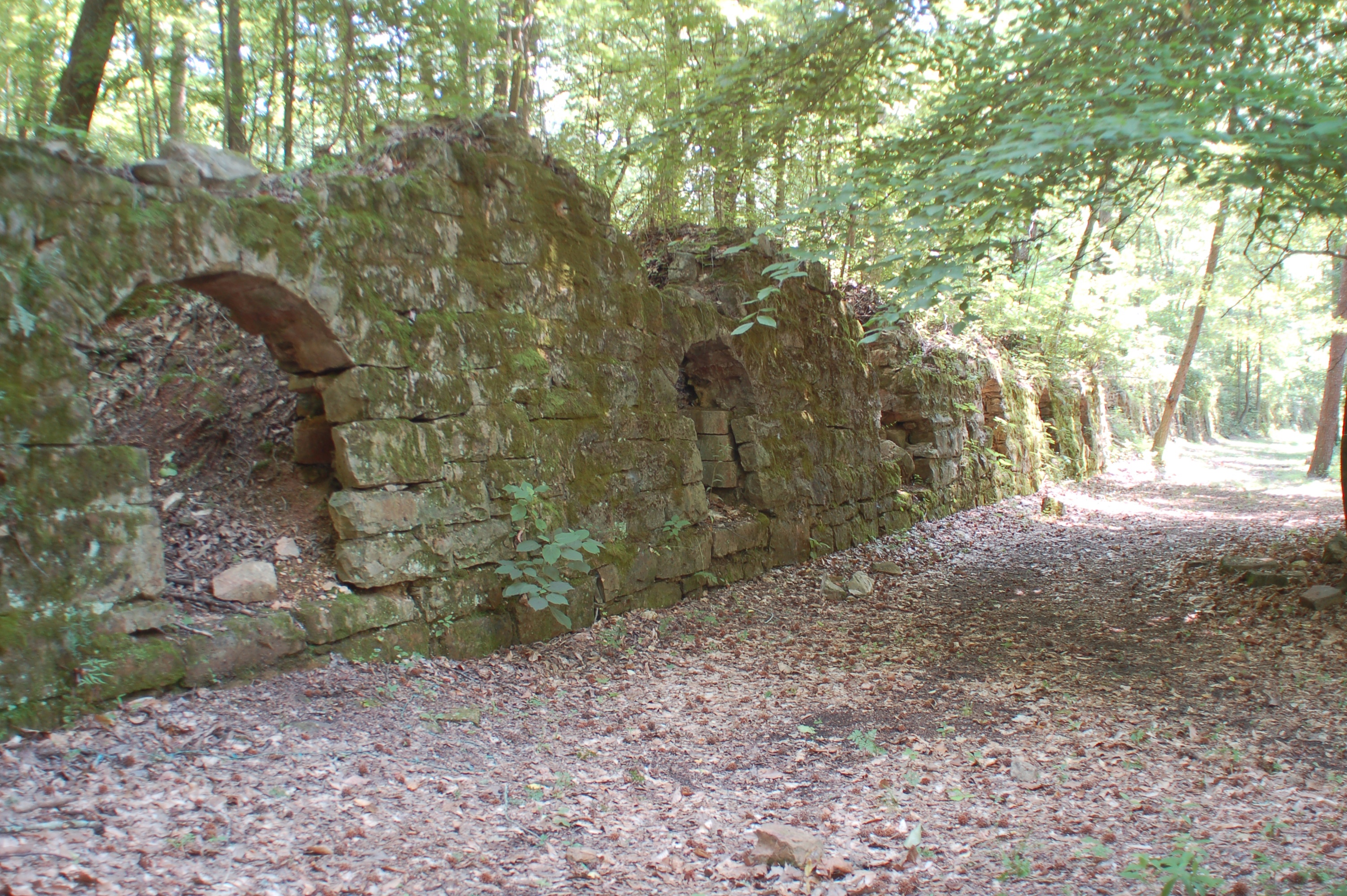 Dunlap Coke Ovens Park and Museum may be part of a new scenic byway being discussed in the Sequatchie Valley.
Planners working on a national scenic byway through the Sequatchie Valley will meet with the public next Tuesday to show off a draft map and take suggestions on top sites to see in the 60-mile-long valley between Interstates 24 and 40.
Anyone interested in the project can check out a draft map at a public open house on Tuesday.
The map already has more than 50 sites scattered across Bledsoe, Sequatchie, Marion and parts of Cumberland counties, said Richard Quin, with Pawpaw Partners, a subcontractor for Nashville-based consultant Kimley-Horn and Associates. Pawpaw Partners is contacted to do the groundwork in assessing potential sites for the byway.
Quin said the map will show most of the sites being considered for the byway route, and people who attend the meeting can suggest additions.
Cumberland County -- not a Sequatchie Valley county -- was added to the project because it has geological and cultural ties to the valley and links Interstate 40 to the route as the northern terminus opposite I-24 in Jasper, Tenn., on the southern end, Quin said. Sites such as the Cumberland Mountain State Park and Grassy Cove National Natural Landmark are on the draft map.
Between those two points are such sites as the historic downtown areas of Pikeville in Bledsoe County and Jasper and South Pittsburg in Marion, the Cookie Jar Café on the Johnson Family Farm in Sequatchie County, state wild areas, forests and parks in all the counties, and even historic industrial sites like the Dunlap Coke Ovens and Museum in Dunlap and the Whitwell-Marion County Miner's Museum in Whitwell, Quin said.
"We've got some very interesting African-American resources like the Pike-ville AME Zion Church and the recently restored Lincoln School that was built in the 1920s," he said. "Of course, there's nothing more moving than the Children's Holocaust Memorial in Whitwell."
Paul Archambault, historic preservation planner and assistant director of community development for the Southeast Tennessee Development District, said people who come to the open house can inspect the draft map's sites and find out what it takes for a site to be listed.
Important details like public access and adequate parking make a big difference, Archambault said.
The work is funded by an $80,000 federal grant that has a 20 percent local match divided among entities in the participating counties, he said.
A finalized map should be released in late November or early December, he said, noting that as more sites are developed, they can be added.