Storm spotters are experts' eyes, ears on the ground when severe weather breaks out

Saturday, March 1, 2014
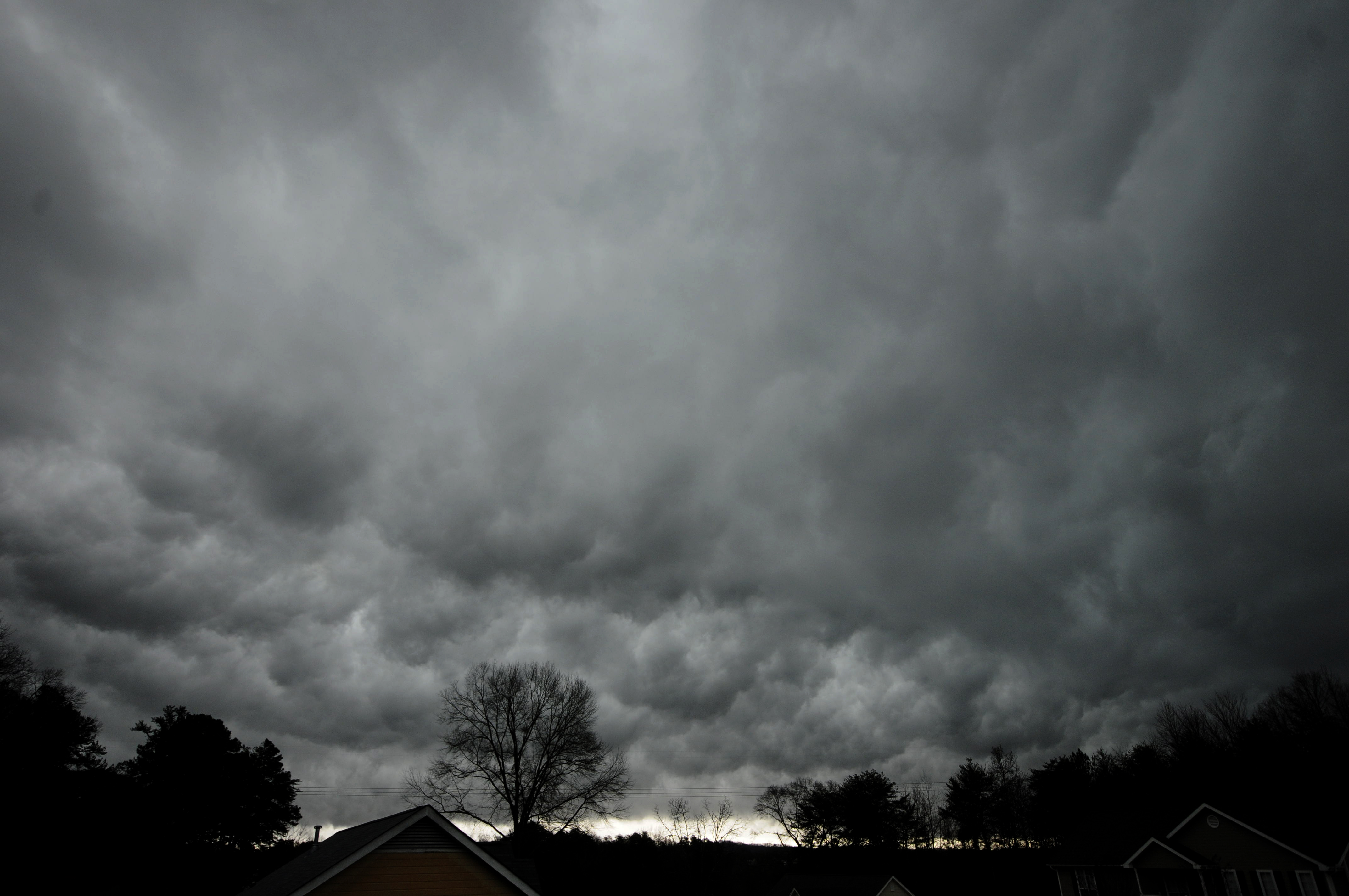 Storm clouds move east over Middle Valley in 2013 ahead of large amounts of rain.
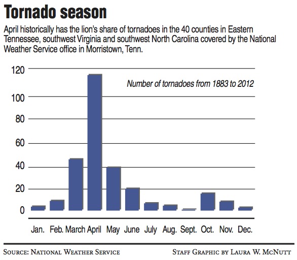
AT A GLANCEUpcoming storm spotter trainings:• March 11, 6 p.m. CDTSequatchie County Rescue Squad Building513 Rankin Ave.Dunlap, TN 37327Contact: Winfred Smith at 423-883-1186 or seqema@bledsoe.net• March 13, 6 p.m. EDTLee University Science Building160 Billy Graham Ave. NECleveland, TN 37311Contact: Curtis Cline at 423-728-7289 or ccline@clevelandtn911.com
Doppler radar is an invaluable tool for weather forecasters. It allows them to see into storms to tell where precipitation is forming - rain, snow, sleet and hail - and whether clouds are rotating in just the right way to form tornadoes.
But it has its limitations.
Chattanooga's closest National Weather Service Doppler radar tower is 45 miles away as the crow flies, in Hytop, Ala.
Due to the earth's curvature, that radar station can track only the weather 3,000 feet above the Scenic City and higher. It can't see below that elevation.
"The radar's our best piece of equipment," said Sam Roberts, a meteorologist with the National Weather Service's Morristown, Tenn., office, which predicts Chattanooga's weather. "But with any good piece of technology, there's going to be limitations."
Enter the storm spotters.
The Morristown office relies on the eyes and ears of thousands of people who have taken a two-hour course to learn how to be storm spotters through the Weather Service's Skywarn program.
Roughly 3,550 volunteers are spread out across the Morristown office's forecasting area that includes 33 counties in Eastern Tennessee, five in southwestern Virginia and two in southwestern North Carolina.
When severe weather strikes, the storm spotters are "activated," or asked to report hazards such as tornadoes, funnel clouds, flash floods and hail.
Lightning - though potentially life threatening - isn't considered severe weather here, because thunderstorms are so common that the Weather Service doesn't want the public to become numb to warnings.
The spotters call in reports through a toll-free phone number or send the information by email or via the Morristown office's Facebook page.
'Gives it credibility'
When spotters report hazardous weather, residents may be more apt to take cover, said Anthony Cavallucci, the Morristown office's warning coordination meteorologist who teaches storm spotter classes here.
"It gives it credibility," Cavallucci said. "We can say spotters reported a tornado."
Getting people to take shelter is especially important in this area, he said, because storms move quickly, and people don't have much time to respond.
The spotters also helped the office tally snowfall during the storm of Feb. 12-13 that blanketed much of the Southeast, including 7.2 inches that fell overnight in Chattanooga.
Cavallucci is midway through teaching spotter classes in the area, including two two-hour classes held Tuesday at the University of Tennessee at Chattanooga.
There was such high demand for the training that UTC had to move one of the classes into a larger lecture hall, said UTC wmergency management specialist Tim Pridemore.
The weather service holds the training this time of year in anticipation of tornado season, which kicks off in a big way in April. Historical weather data from 1883 to 2012 shows that tornadoes spike in April in the 40-county area covered by the weather service office in Morristown.
Saving lives
Storm spotters save lives, according to training material handed out at Cavallucci's Tuesday class.
"During the past 10 years, tornadoes, severe thunderstorms and flash floods have killed nearly 2,300 people in the United States and injured thousands of others," the Basic Spotter's Field Guide states. "Because of storm spotter reports ... this death toll was reduced by more than 800 from the previous 10 years."
Nationwide, nearly 290,000 volunteers participate as storm spotters.
The National Weather Service also offers a program that allows volunteer weather buffs to submit precipitation reports called Cocorahs, which stands for the Community Collaborative Rain, Hail and Snow Network.
The network originated with the Colorado Climate Center at Colorado State University in 1998 thanks in part to the Fort Collins flood a year earlier, according to its website, and is now the largest provider of daily precipitation observations in the United States.
The home page of its website showed a map of the United States covered with different-colored dots representing precipitation reports from 7,032 volunteers around the nation.
Participants use low-tech equipment, such as rain gauges, and are encouraged to make reports daily. Smartphone apps are available to make reporting easier.
Cocorahs volunteers in the 40-county Morristown, Tenn., weather region also helped provide snowfall totals during the recent big storm, Roberts said.
"We get quite a few reports from Cocorahs," the meteorologist said. "The more data we have, the better."
Contact staff writer Tim Omarzu at tomarzu@timesfreepress.com or 423-757-6651.