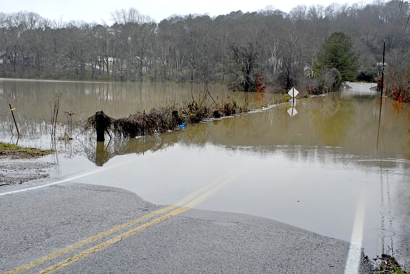
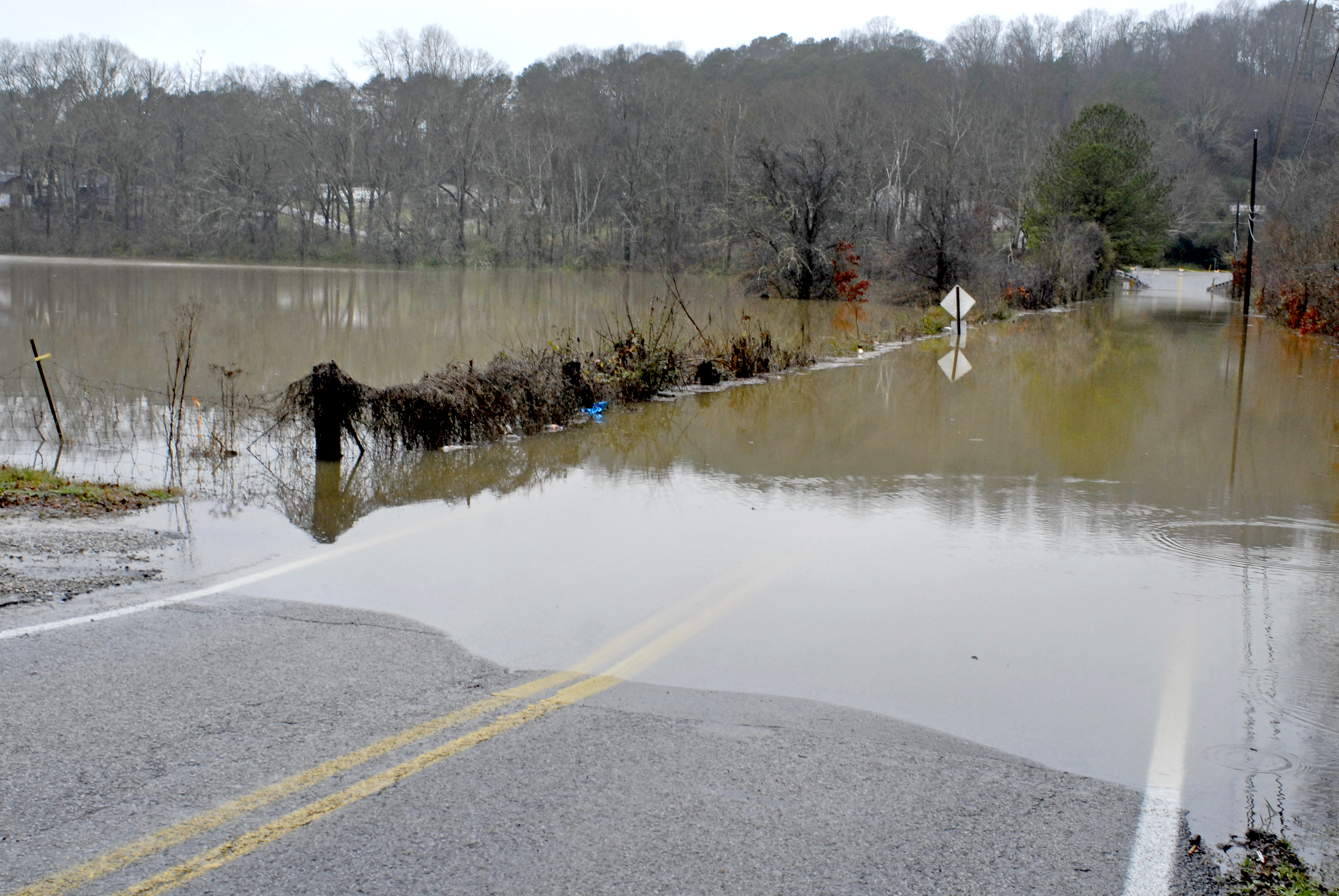
 Flood waters from Mackeys Branch cover the west end of Davidson Road in East Brainerd. The Chattanooga area expects more rain today and Wednesday.
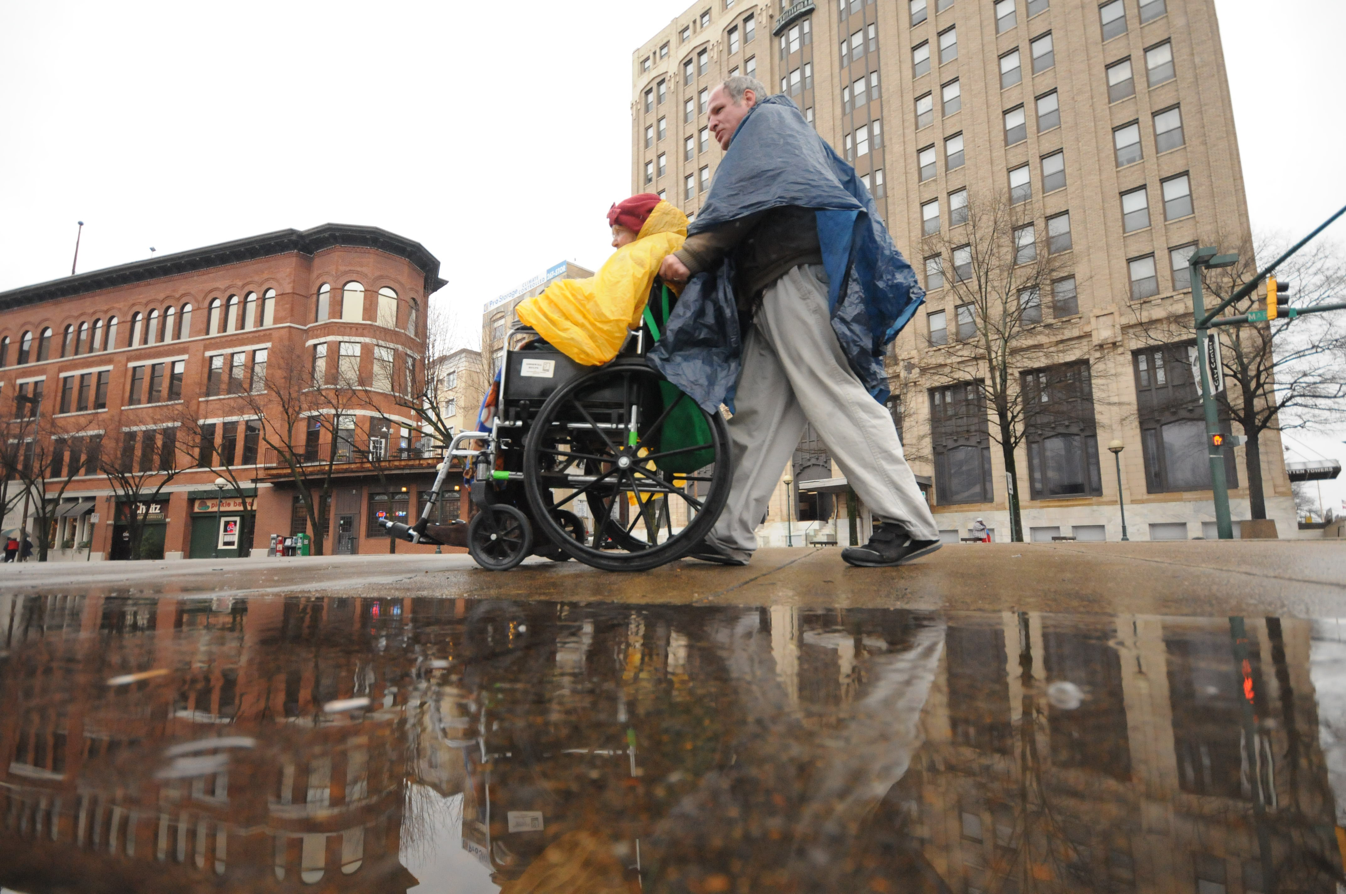 With only plastic and poncho for cover, John and Rosie Meadows begin a seven-block trek to "the store" in the rain Monday.
PHOTOS OR VIDEO?
How is the flooding where you are? Share your photos and videos with us by emailing them to shots@timesfreepress.com
SCHOOL CLOSINGS AND DELAYS
• Bledsoe County Schools: 2-hour delay• Catoosa County Schools: 2-hour delay• Chattooga County GA Schools: 2-hour delay• Cherokee County NC Closed• Chickamauga City Schools: Opening at 9:30• Dade County Schools: 2-hour delay• Etowah City Schools: Closed• Flintstone Child Care: Pre-K will have a 2-hour delay• Marion County Schools: Closed• McMinn County Schools: Closed• Meigs County Schools: Closed• Oakwood Christian Academy: 2-hour delay• Polk County Schools: Closed• Richard Hardy Memorial School: Closed• Sweetwater City Schools: Closed• Tennessee Wesleyan College: Closed• Walker County Schools: 2-hour delay
Chattanooga and the surrounding area have had a wet week, and the soggy weather is expected to continue through Wednesday.
The rainfall prompted the National Weather Service to issue a flood watch for southeastern Tennessee, North Georgia and North Alabama. The watch is in effect until Wednesday morning.
"A flood watch means that conditions are right for rivers and creeks to flood," said Chief Meteorologist Paul Barys of WRCB-TV 3.
Heavy rain and flooding caused some road closures in Chattanooga and the surrounding areas Monday evening.
Three roads closed in or around the city were Davidson Road, Camp Jordan Parkway and Grubb Road at Old Hixson Pike, according to Chattanooga police dispatchers. Soddy-Daisy had high water citywide, but no roads had been closed there Monday night.
Polk County, Tenn., had a lot of standing water that was expected to start flooding roads last night, according to dispatchers. Areas officials were watching were the Ocoee area near U.S. Highway 411 and state Highway 30 near Greasy Creek.
In Georgia, water covered the 200-block of Kay Conley Road near Beaumont Road in Walker County, and there was some flooding on Hickory Flats Road in Whitfield County, dispatchers said.
Catoosa County Schools are delaying the opening of schools today by two hours because of high water. Chickamauga City Schools delayed opening until 9:30 a.m.
"This would be more of a nuisance situation," said Kent Frantz, service hydrologist at the National Weather Service in Peachtree City, Ga. "It's not expected to damage structures or anything like that. It'll mostly involve the flood plain, coming out into fields and low-lying areas."
But depending on the amount of rainfall, a more severe rise in water levels is possible.
"The potential exists for more widespread flooding of major roads and things of that nature: farmlands, not just the creeks. It could impact entire neighborhoods," said Shawn O'Neill, meteorologist for the National Weather Service in Morristown, Tenn.
Total rainfall through Wednesday is expected to be between 2 and 4 inches, depending on the location, according to Barys.
"Anybody who lives in a flood-prone area just needs to watch the levels, and if the level starts to go up, they need to get out," Barys said.
Erik Hopkins, public information officer for the East Ridge Police Department, offers another word of caution to those out on the road.
"The No.1 thing to remember is that if you see high water, stop and turn around. Tennessee has a little slogan for that: 'Turn around; don't drown.'"
West Tennessee experienced freezing rain Monday with more expected today. The National Weather Service issued a winter weather advisory for much of Middle Tennessee on Monday, with a light mix of snow and freezing rain possible through this morning.
An ice storm warning was been extended through 6 p.m. Monday for the northern Mississippi Delta, where ice was reported on roads and bridges in numerous counties. Many schools closed early.
In Alabama, the National Weather Service said persistent rains already have caused flash flooding in areas, and it issued flood warnings for the Tennessee Valley region and western Alabama.
Meanwhile, forecasters said there's a chance for freezing rain in northwestern Alabama through this morning as cold air filters into the state.
The Associated Press contributed to this story.