

Thursday, October 29, 2026Oct 29

This story is free to read.

Hurricane Isaias to bring high winds, heavy rain to Chattanooga region Saturday

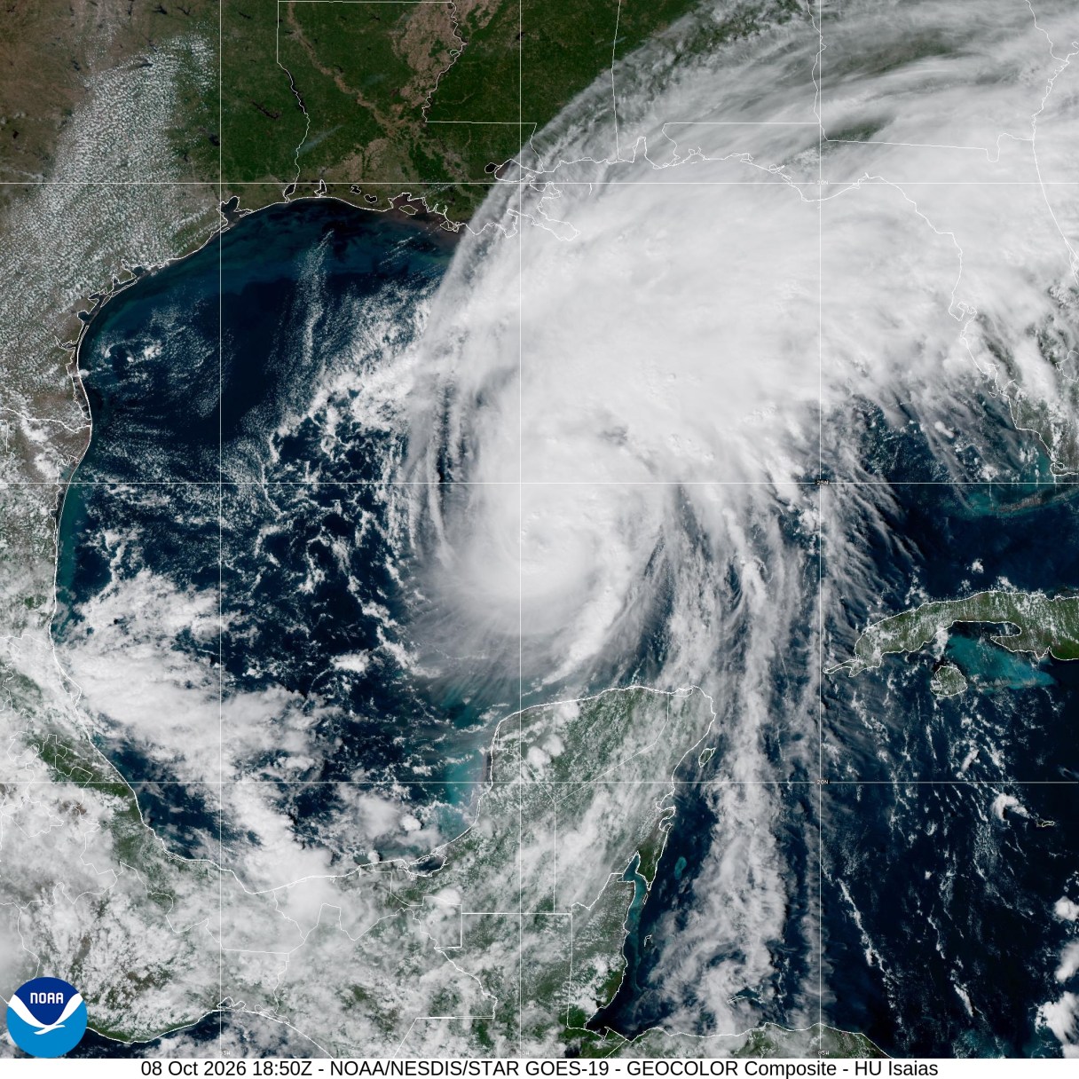
National Weather Service / This image from the National Weather Service Hurricane Center in Miami shows Hurricane Isaias as it takes a generally northward track toward the Florida Panhandle at 4:40 p.m. Oct. 8, 2026. The storm is expected to bring high winds and heavy rain to the Chattanooga region late Oct. 10 and Oct. 11.
National Weather Service / This image from the National Weather Service Hurricane Center in Miami shows Hurricane Isaias as it takes a generally northward track toward the Florida Panhandle at 4:40 p.m. Oct. 8, 2026. The storm is expected to bring high winds and heavy rain to the Chattanooga region late Oct. 10 and Oct. 11. National Weather Service / This image from the National Weather Service Hurricane Center in Miami shows Hurricane Isaias as it takes a generally northward track toward the Florida Panhandle at 4:40 p.m. Oct. 8, 2026. The storm is expected to bring high winds and heavy rain to the Chattanooga region late Oct. 10 and Oct. 11.

Hurricane Isaias is expected to slam into the Florida Panhandle late Friday or early Saturday as a Category 2 storm, plowing north through the Chattanooga region and bringing winds up to 70 mph across East Tennessee’s mountains and foothills.

It’s pronounced “ees-ah-EE-ahs.”

Strong winds from Isaias are increasingly likely in and around Chattanooga on Saturday morning, when 2 to 3 inches of rain is predicted, according to National Weather Service warning coordinator meteorologist Anthony Cavallucci at the office in Morristown, Tennessee.

The former tropical storm strengthened Thursday into a Category 1 hurricane with sustained winds between 85 mph and 105 mph, and the weather service predicts Isaias will make landfall as a Category 2 storm with sustained winds of near 110 mph.

A flood watch is in effect from late Friday through Sunday morning for the Chattanooga region and throughout the storm path.