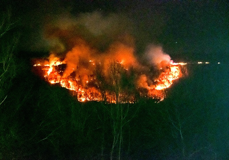
Winds forecast as high as 60-70 mph in Tennessee's Appalachian Mountains into Tuesday morning could fan wildfires outside containment lines, and state officials are concerned ongoing fires in the Chattanooga region could worsen before rain arrives.
Along with boosting ongoing fires, winds could also bring down trees and power lines, sparking new fires as the entire region continues to plunge into exceptional drought, according to Cherokee National Forest spokesperson Christopher Joyner. The National Weather Service issued a "red flag" warning Monday for dangerous wildfire conditions through Tuesday.
"Firefighters on the Cherokee National Forest are diligently working to mop up, secure containment lines and maintain contingency lines on the Tweed, Rye Patch and Bullet fires prior to the wind event," Joyner said in a news release. "Containment on the Bullet and Tweed fires has increased to 40% and 85% respectively."
(READ MORE: Multiple wildfires burn in Northwest Georgia; one found to be arson)
Officials urge the public to obey fire restrictions set by federal, state, and local jurisdictions.
"New wildfire starts are burning rapidly and are difficult to control," Joyner said.
The Cherokee National Forest spans 10 counties along the border with multiple states with various levels of fire danger and restrictions, federal officials said. For now, federal officials are restricting the use of a fire outside of a developed recreation area.
State-issued burn bans are in place in Franklin, Grundy, Sequatchie, Rhea, McMinn and Polk counties, and burn permits are restricted across East Tennessee, according to the Tennessee Division of Forestry. Hamilton County officials have warned residents not to burn anything outside.
Tennessee's wildfire map Monday showed an active, 125-acre wildfire in Marion County on Whitwell Mountain. The blaze was about 15% contained Monday, authorities said.
"It's going into tomorrow," Joel Blackburn, assistant district forester, said by phone Monday as he arrived at an ongoing wildfire. "In Whitwell, it's likely to worsen it. We have multiple dozers coming down. We're going to try to get ahead of it, but with the wind tomorrow, it will dry out pretty quickly."
Plentiful rain will help but won't last, Blackburn said.
Firefighters were in a back-and-forth battle Monday.
"They've got the right flank in pretty good shape," Marion County EMA Director Steve Lamb said of the wildfire's status by phone from Whitwell Mountain. "The state's dropped water from helicopters, and that seems to be helping some. But the left flank broke through."
Local and state firefighters were being assisted by firefighters from neighboring agencies, Lamb said. Guests at a small resort near the wildfire were evacuated Sunday, he said, but no permanent residents have been evacuated.
(READ MORE: Breezy forecast has officials watching for wildfire spread in the Chattanooga region)
Tennessee usually experiences a couple of "mountain wave" wind events every year, but this one teamed with exceptional drought conditions is particularly dangerous, Blackburn said.
"This mountain wave event will be similar to the one we had in Gatlinburg in 2016," Blackburn said of the historic wildfires that swept through the town in the Great Smoky Mountains National Park in November 2016, killing 14 people and destroying thousands of homes and businesses. "It was the same phenomenon."
Mountain waves develop on the downwind side of mountains, according to the National Weather Service. The waves are generated when strong winds flowing toward mountains are raised up over the mountains. As the winds rise, they may be redirected toward the surface, but instead of staying down, the winds continue in an up-and-down, wave-like pattern.
Strong wind will potentially spread wildfires before an expected 0.75 and 1.75 inches of rain fall by around 2 p.m. Tuesday, Local 3 News meteorologist Alison Pryor said in her morning weather blog. The forecast high for Tuesday in the Chattanooga region is 66 as rains taper off, and Wednesday's high will be around 54 with a partly sunny sky heading into a cold Thanksgiving morning in the 30s and an afternoon high of 58 with a mix of sun and clouds.
In Georgia, the wildfire map shows three ongoing, active wildfires in Dade and Walker counties. All are at least 98% contained. Alabama's wildfire map showed no active blazes Monday morning in DeKalb or Jackson counties.
U.S. Forest Service officials said because of the Black Bear fire in North Carolina, portions of the Appalachian Trail remain closed from Interstate 40 to Brown Gap, including the Groundhog Creek Shelter.
Contact Ben Benton at bbenton@timesfreepress.com or 423-757-6569.
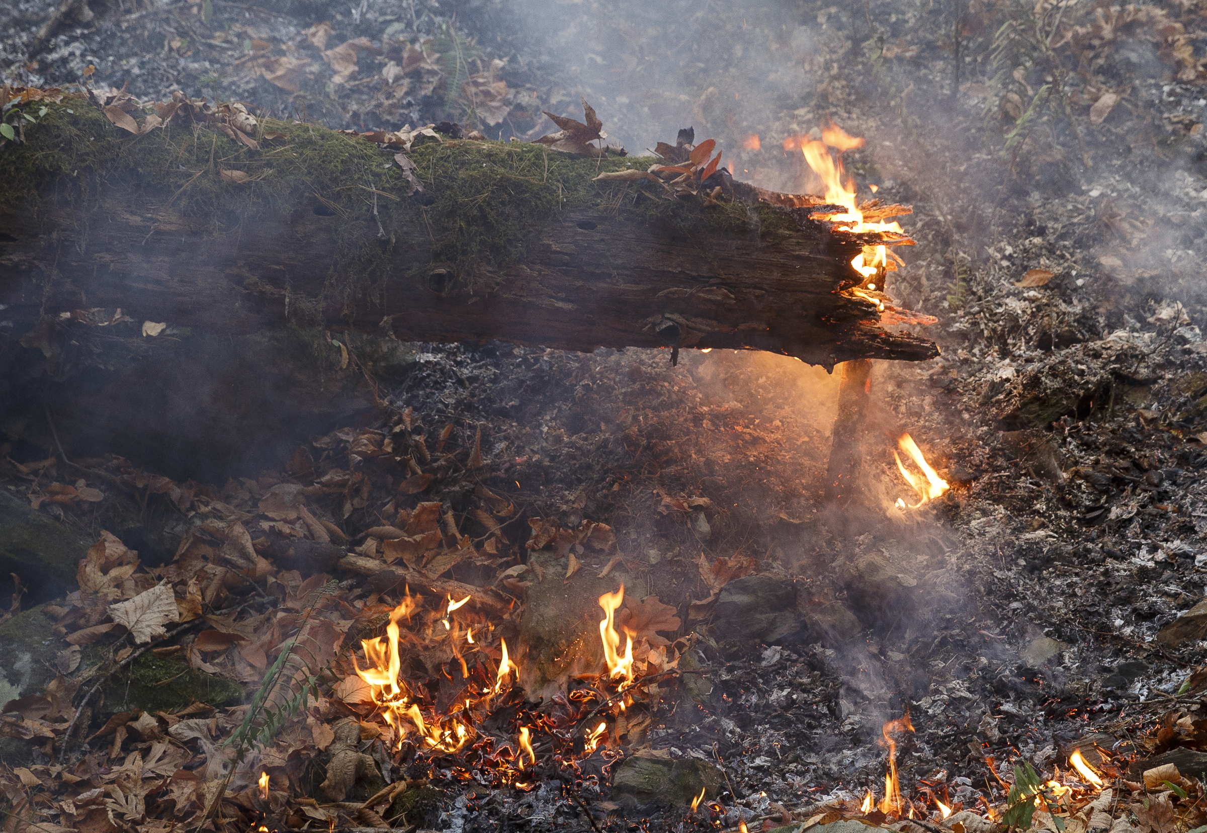 Staff Photo / A hot spot glows within a log as firefighters battle the Rough Ridge wildfire in the Cohutta Wilderness of the Chattahoochee-Oconee National Forest Nov. 18, 2016, near Chatsworth, Ga. Forecasters are warning of winds reaching speeds of 60 mph or more into Tuesday in the Appalachians.